One Last Stop

Cruising along winding mountain roads, I noticed the trees were green with new growth. All day I had blue skies overhead, but now they were showing rain was on the way. The springtime weather in north Georgia could be like this. Warm and clear one minute, cold and wet the next. I should know, I was here before. Since returning from my hike, the world of cars, concrete, and deadlines had clawed it’s way back into everyday life. I wanted to go back.

So, on a new day, in a different April, I took the trip back to Springer Mountain. Not to hike for 5 months, that wasn’t happening. But to go back to where it all started. To pop into the AT offices, pay my respects to Earl Shaffer, and cross under the arch. To walk up Amicalola Falls and visit the hiker lodge. And to stand on top of Springer again, where my journey began.

The second time up wasn’t nearly as strenuous, or fueled by adrenaline. It certainly didn’t take as long, a much lighter day pack helps with that. Perhaps some familiarity was a comfort. Either way, the joy of adventure I had standing on the summit was the same. Retracing my first steps up to the top. Standing there at the beginning, now with the knowledge of where this path would climb, wander, and ultimately end. Where it had lead me, with each memory along the way.

I felt proud of what I had accomplished, walking to the other end of the northward path that laid before my hardened feet. Happy that I decided to start, that I didn’t give up on myself during, and even with how it had to come to it’s eventual end. Bittersweet, remembering the wonderful people I met along the way, and all of the amazing places we discovered. I was maybe even a bit sad that we weren’t ‘out there’.

I missed it. Even with the bruises, the heat, the bugs, and the nasty laundry attendants. I still missed it. But at least for the moment, staring down that path of people, places, and adventures, I was High 5 again. But High 5 knew that even though he had experienced the length of the Appalachian Trail, he wasn’t quite finished yet. I needed to finish my story.

So.

Here we go…the final installment of a long overdue and mostly remembered adventure through the great state of Maine.

Maine was tough. I remember that’s how I left this. Tough and beautiful and untamed. I have said many times since: I thought I knew what wilderness was, then I got to Maine.

The first day in the last state, we were introduced to Mahoosuc notch. This deep gap appropriately named the “toughest mile”, amounts to a tedious stretch of … boulders. That’s right. Some sadistic trail planner, somewhere, decided to send the trail directly over a pile of giant boulders. For one mile. Over, under, around, and through we climbed our way across this jungle gym of rocks. Ultimately, we had fun with it and made our way out safely. A shout out to Johnny B for sharing in the absurdity of it all. Always go high.

The second day in the last state, I walked up on what was, and still is, the most majestic animal I have ever encountered in the wilderness. The North American Moose. A cow, standing on the trail about 40 yards away. When she spotted us, this massive figure turned and sulked away into the forest. With no need to go around small trees, she simply pushed them down with her size. Broadside, she was at least 6 feet tall to her shoulders. Incredible.

The third day in the last state was the first day of fall, and my 150th day on trail. I had walked for five months and through three seasons. In a couple more days, I would hit the 2,000mi mark. For the first time, the thought of actually finishing this journey started to become a reality. Katadhin was so close, and I could actually start to plan out the last few days. I also started thinking about how I was getting back home. I knew I was ready to be finished.

Not that I wasn’t enjoying the journey, and not that I was looking forward to the concrete and cars again. But, it was here that I knew I had done it. I was going to make it through to the end. It was an odd place, missing home while knowing I would miss being out on trail.

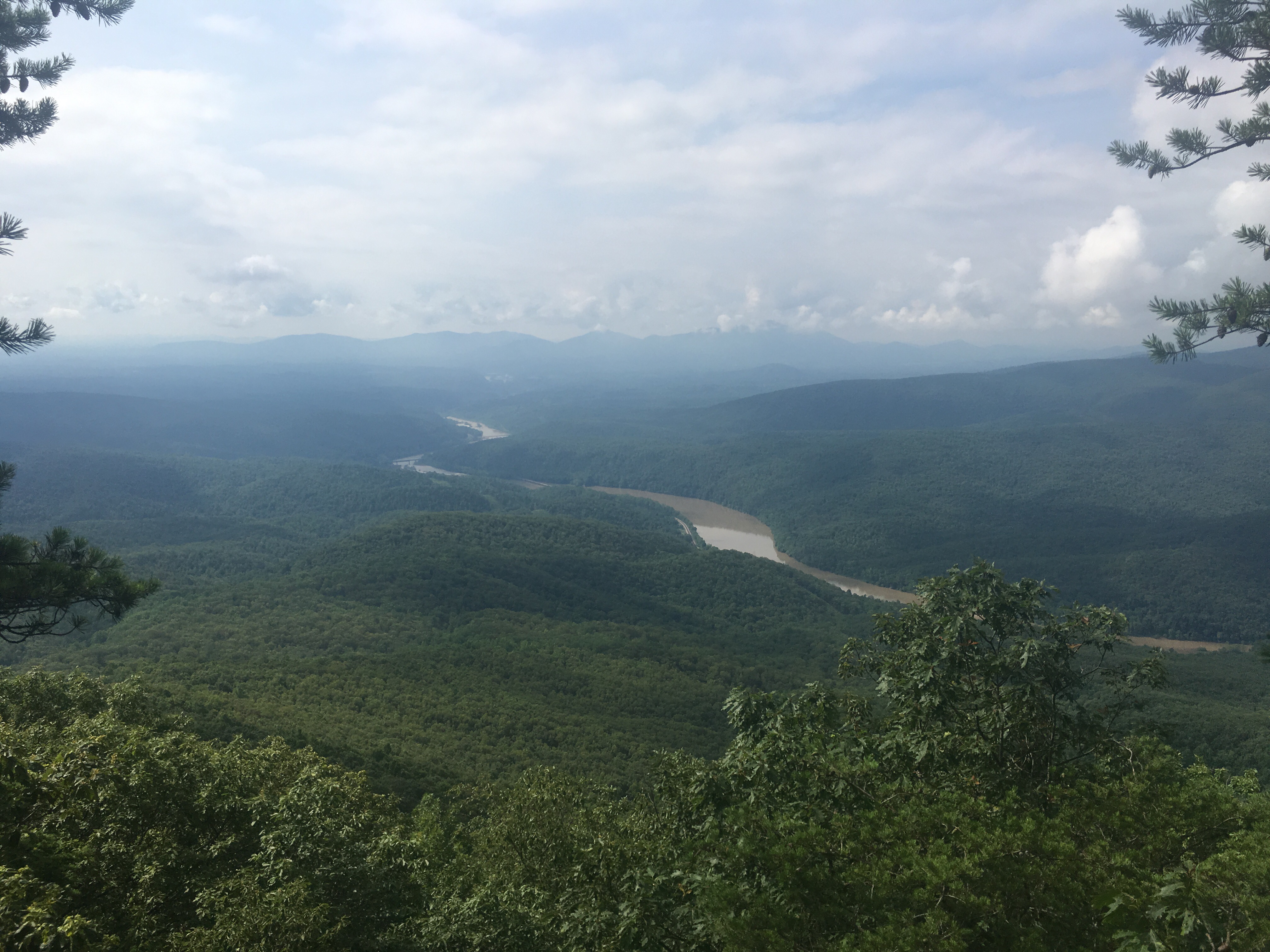
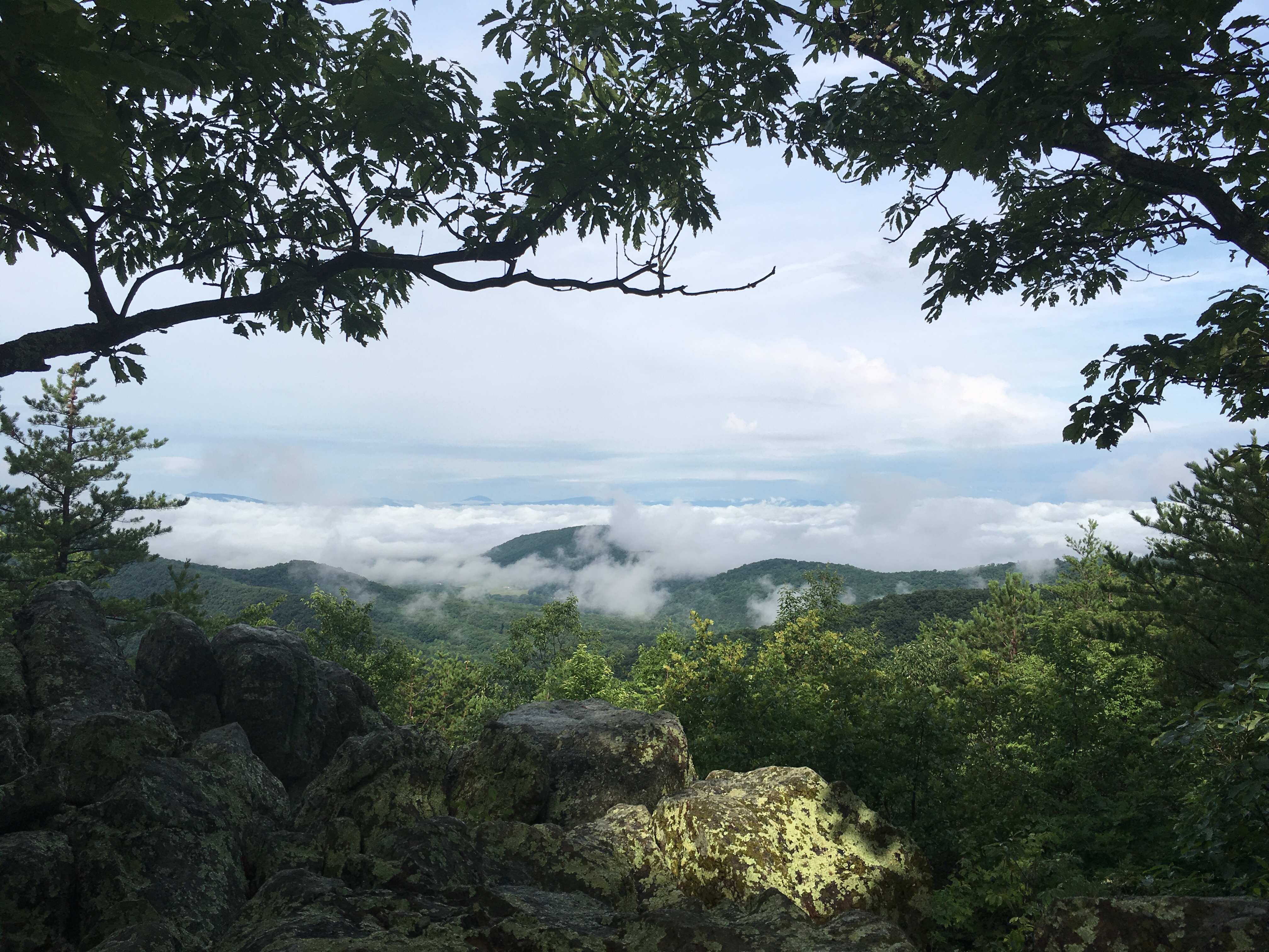
Through the towns of Rangely and Stratton, the 14th state of my hike showed its rugged beauty. Some of the largest mountains, coldest nights, and soggiest days were here. The wind up on Saddleback nearly blew me off the side of the mountain. To stay warm at night, I was now sleeping in layers I didn’t even know I had. We were fording wild rivers daily. I loved every bit of it.

The first leaves of autumn began to show themselves. From green tunnels to pathways filled with gold, red, and orange. The sea of color from above treeline was remarkable. The rose tinted shade visible when the light came through the trees. It was like nothing I had ever seen during any southern fall.

Over Spalding and Sugarloaf Mountains, the Bigelow range, and Avery Peak. Setting up camp each night along the mountain lakes. Cooking on beach side fires. Listening to the loons sing me to sleep. Waking up in the clouds to watch the morning sun burn away the fog over the water. Observing the north star so high in the sky. A reminder of how far north I had come.

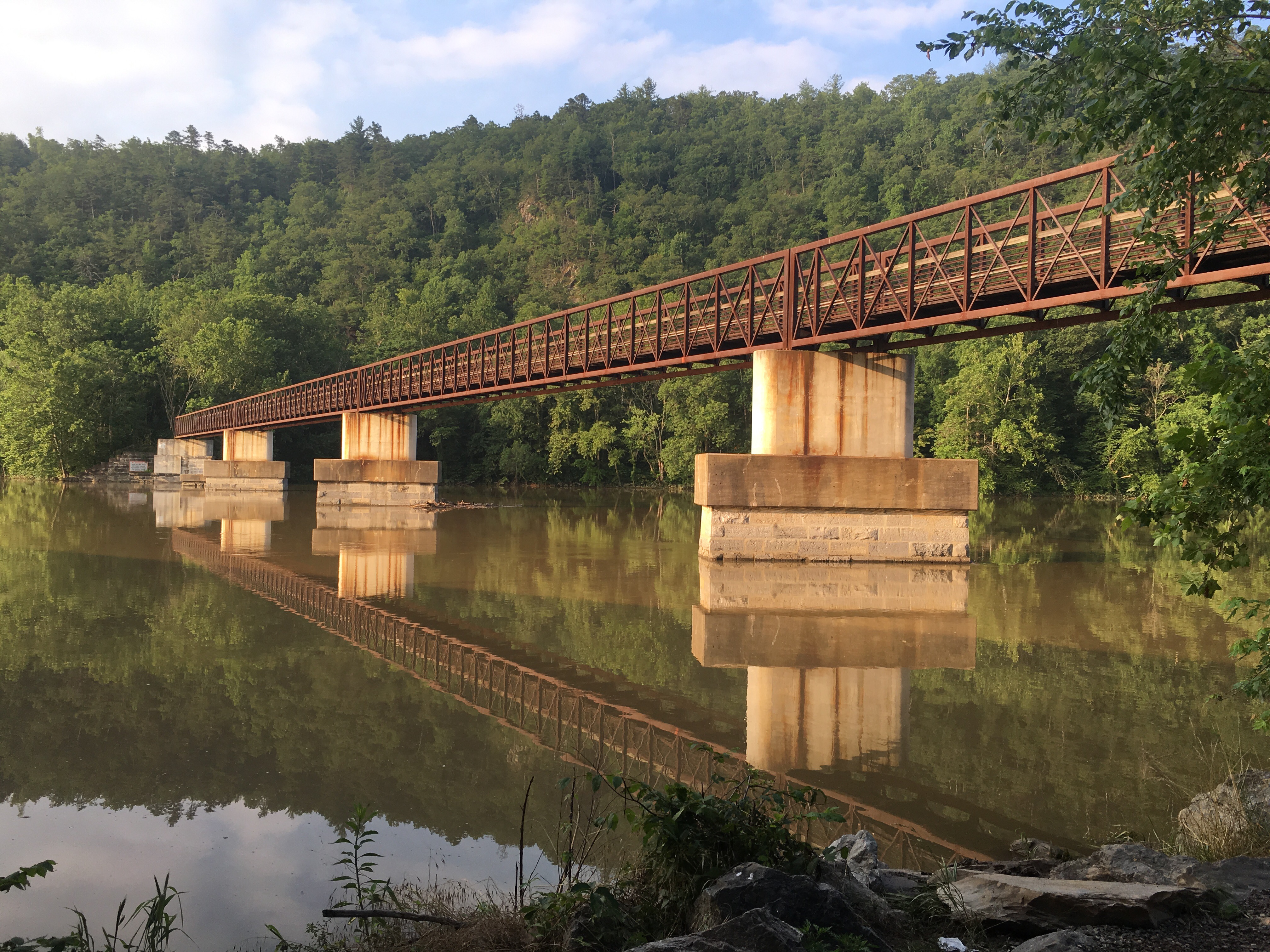
To get into the town of Caratunk, hikers have to cross the Kenebec River, the only river crossing on the AT that cannot be completed on foot. Instead, there is a ferry service that will canoe hikers across.

After a quick stop, I’d push a couple of long days into the last town on trail, Monson. Here is where I would take my last day off to gear up for starting the longest stretch of the trail without any resupply, the Hundred Mile Wilderness. Monson is also where I’d register for my stay in Baxter State Park, where the final ascent would be. It was so close.

So close, that two days into the Hundred Mile Wilderness, I got to see her in all her glory. The final mountain, our last trail marking, crowned in clouds, Katahdin. My last stop.

This was a bittersweet time on trail for all of us. Collectively, we were still all moving in the same direction, but we knew that we would soon be taking paths that did not converge any longer. Every time we caught up, it was implicit that contact info should be exchanged. No more catching each other in a few days. In a few days we would be catching rides, busses or flights. We even had to learn everyone’s ‘real’ names.

Each day we walked closer, and this dominating prominence grew in size. Until we were finally at her doorstep. The Abol Bridge marks the end of the hundred miles, and gave us a front row seat to our goal. Surreal.

The temperature outside was also dropping quickly. Ice had become a common part of the morning, and there was some concern that the mountain would be iced over. Luckily for the hikers summiting Katahdin on Tuesday October 11, the ice left behind from the previous day’s storm would burn off early in the morning. The skies would clear out, the wind would be manageable, and the ‘all clear’ would be given from the forest ranger.

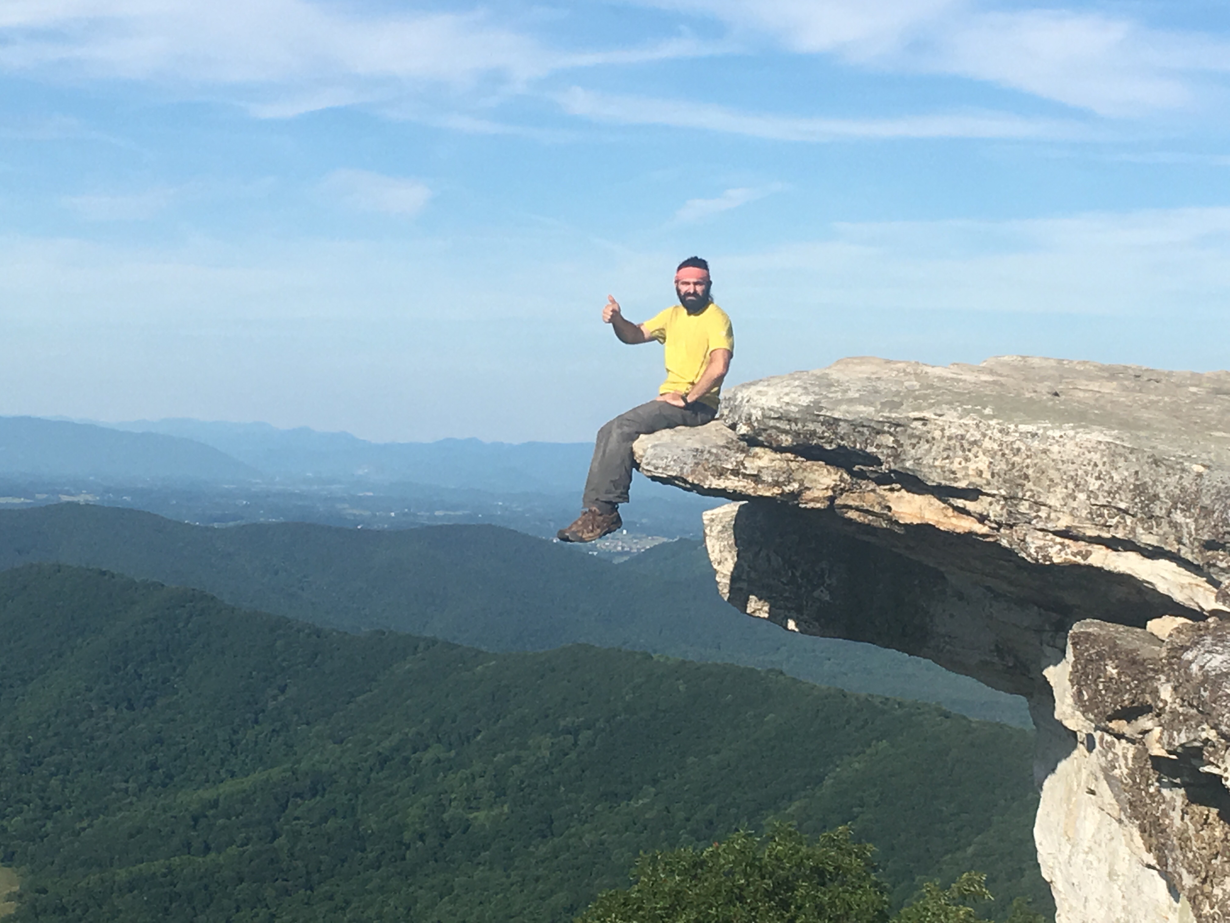
Nothing can compare to the experience. A truly sacred mountain. Such reverence is given to it by the people of Maine. It is multiplied by months of veneration from all northward hikers.

Jitters had me up at 5:00a, coffee and breakfast by 6:00a. The weather report (and good news regarding the ice) got to me soon after. It was going to be cold, but no sense in waiting, it was go time. I started the ascent. The views and colors in the morning light were stunning.

Four miles of technical climbing, and all of it amazing. Fueled by adrenaline and coffee, I got up onto the flat expanse named the Tableland. The gateway to the peak, it is a unique landscape of exposed grasses, streams, and rocks. Bleak and beautiful.

One final time, the weather had provided a perfect day. The wind had calmed, and the sun was shining. The ice was gone. I had a clear sightline to the top. One mile away, Baxter Peak. The sign on the northern terminus, I could see it. My last steps brought me up one more climb, and I was there.

What a moment. I embraced a wooden sign and five months of walking. I cried. I screamed. I laughed maniacally. Every confused day-hiker on the summit that morning got a strong high five from this wild, bearded creature. It was fun to watch them figure it all out.

I had walked from Springer Mountain, Georgia to Katahdin, Maine.

For the next 4 hours, I stayed on the highest peak in Maine. Reflecting, visiting, relaxing. It was a joy to watch my friends have their own first moments as they each made thier way up. An awesome and proud moment for each of us.

The funny part was that we had focused, understandably, on getting up Katahdin and finishing our last miles, But we still had to hike back down, and get into town. There was this moment of, “Oh yeah, there are a couple more miles left because, you know, we aren’t getting a ride from the top of Katahdin”.

We enjoyed our last few miles of walking back down, and we found rides into Millinocket. Cleaned up, we continued our celebration over dinner. I was sitting at the bar at a restaurant in town when Woops walked in. My trail angel had visited, hiked, and resupplied me through the last five and a half months on trail (and long before that). Her support had been central to this journey. She had certainly experienced her own journey parallel to mine. It was deserving for her and heartwarming for me that she could join the commencement.

It was done. I was tired and satisfied. That day with Katahdin will forever be imprinted in my memory, as well as each day leading there.

Much of this blog was taken from a journal I kept throughout my hike. Each evening I would finish up my day writing about my adventures, observations, and thoughts from the last 24 hours. I though it would be fitting to end this story with my last entry on October 11th:

“The hike is over. I’ve walked 2200 miles in 5 months and 15 days. Right now, I’m happy to have accomplished my goal, proud that I stuck to it, a bit relieved that I’m done hiking, and curious how life will be going forward. It’ll be a great adventure.”

Thank you for coming along with me. Thank you for cheering us on. Thank you for your attention span.

Happy Trails,

-High 5

Hanover, NH to Andover, ME: The White Mountains and Southern Maine


img_1932

SPOILER ALERT!

Seriously, don’t read the next paragraph if you don’t want to know that I made it to the end.

Let’s jump ahead for a second here.  So everyone knows…I did it, guys.  I finished the AT.  2200 friggin’ miles.  It feels amazing to write this.  We’ll get into the tale, the pictures, the whining, crying and chest-bumping in the next post because I don’t want to sit in front of a computer screen for the 100 hours it’ll take to write that much.  But, for now, I will say (among many) thank you to each of you for following along on this adventure.  Be proud of your attention span.

img_2055

The White Mountains.

Remember a few months back when I was referring to a couple places along the AT that everyone HAS to mention all the time?  The Whites top that list, and they should.  They span across nearly all of NH, and are home to just over 100 AT trail miles of high elevation and exposed peaks and ridges.  For the distance they cover, they are the most challenging and most stunning terrain we would experience.

And the most dangerous.

Mt. Washington.

I may have mentioned it.  This 6288′ behemoth isn’t the tallest peak along the AT, that title belongs to Clingman’s Dome.  But it is most certainly the biggest mountain.  Seen from 100 miles away, talked about for ten times farther.  Home to the most erratic weather in the Americas (maybe the planet), and the highest wind speeds humankind has recorded.  No other mountain wears a plaque naming the 150 people who have died on it.

But, let’s not get ahead.  (I know.)

img_1909

From the get-go, the trail through New Hampshire was RUGGED.  Rocks everywhere and tough climbing.  Class 4 climbs were not uncommon.

img_1930

The first mountain in the Whites was Mt. Moosilauke.  A long and steep early morning climb was worth the effort to have a late breakfast on the peak.

img_1912

Over the big Moose, I was into Lincoln, NH where thru-hiker Dan and his wife, Nanette were gracious enough to offer a place to stay and wash up.  Thanks, guys!

After a little bit of rain, the sun reappeared and I was through Kinsman Notch and over North and South Kinsman Mountains.  The late afternoon views were wonderful.

img_1938

img_1933

Down into Franconia Notch and back up again onto the Franconia Range.  Little Haystack Mountain, Mt. Lincoln, and Mt. Lafayette offered some incredible scenes on a crisp, clear day.

img_1946img_1950

The next day would bring more great weather up Mt. Garfield, South Twin Mountain, Mt. Guyot, and the beautiful Zealand Falls.  I’d make a peaceful camp in Crawford Notch along the Saco River after a long day.

img_1970

img_1980

The next morning I realized I was there.  I was in the Presidential Range and on the doorstep of Mt. Washington.

…and there was a freaking storm coming.

img_2016

Let’s talk about the huts for a minute.  Throughout the Whites there are shelters known as huts.  These shelters exist as a place of refuge in inclement conditions for adventurers traveling through the mountains.  They’ve evolved a bit over the years into more of a reservation only weekend hiker’s mountain getaway from city life, but at their core they are there to keep people out of bad weather.

There was a hut 7 miles away.  That morning I’d get going, watching the sky, up Mt. Webster and later Mt. Jackson.  I wasn’t too far from the hut when the wind, rain, and clouds rolled in.  It was as if I was hiking in a tropical storm.  I got wet.  I tried not to get blown over.  And I hauled ass.

I made it to the hut as the climate deteriorated, dried myself out, and had a hot meal.  I wasn’t going any further that day.  A Mt. Washington summit would have to wait.  Later, I learned that visibility above treeline had dropped to zero and wind speeds would reach over 100 mi/hr.  A shout out to Chris and the Mizpah Crew for letting me stay!

img_2018

For all the bad weather that day, the next day was worth the wait.  Clear, blue skies and nearly no wind.  I couldn’t have asked for more perfect conditions to hike the Presidential Range and to summit Mt. Washington.  What a day.

img_2051

img_2070

In the next few days, I would make my way over Mt. Madison, down into Pinkham Notch, over the Wildcats, and into Gorham, NH where I would say goodbye to Mt. Washington and the White Mountains.  A truly awesome section of trail.

img_2116

After a stop in Gorham, I crossed my last state line.  13 states were complete, 1 was left.  I was now in Maine.

img_2132

Southern Maine continued the beauty that I saw through New England.  It also ramped-up the rugged, technical climbing I experienced through NH.

Southern Maine was TOUGH.  But it also had some amazing views.

img_2129

Just a few more days until I made it into Andover, ME.  My first town in my last state.

Katahdin was now on the horizon.


SFSSF:

Miles: 1930.7

Highest Elevation: 6288′ (Mt. Washington)

Mountains: 221!

Pop Tarts: 71

Triple Doubles: 4

Kent, CT to Hanover, NH: Into New England

Ok, I’m back.  Sorry for the long break between updates.  This one will cover a good bit of ground…

img_1643


Before leaving CT, I’d hike through the town of Falls Village and the amazing falls on the Housatonic River.

img_1641

Then, I was into the 11th state of this journey, Massachusetts!

img_1660

By now the weather had finally cooled, giving us reasonable temperatures.  And, after being at low altitudes the last few weeks, MA brought back some elevation.  A tough climb over Mt. Everett brought me into the highland region known as the Berkshires.  I’d stop in the town of Great Barrington for a couple days to hike with Woops again!

img_1669

Pretty area, with plenty of views.

img_1653img_1678

Farther north I’d climb Mt. Greylock, the highest peak I’d seen since Virginia.  It was great to get into some real elevation again.  Also, I knew I was getting into the Green Mountains.

img_1724img_1704

And just like that, I said goodbye to MA and hello to Vermont!

img_1742

Let me start by saying this.  Vermont. Is. Beautiful.  I know weather plays a big part in how much you may or may not like a certain section of trail, and living outside was exponentially more bearable here.  I get it.  But, this state has something about it that other states just didn’t have (and, no, I don’t mean relaxed marijuana laws…).

The trails here are some of the best.  The Green Mountains are a place I would recommend to anyone looking for an outdoor adventure.  The people are incredibly friendly.  Not that other places aren’t nice to visitors (not you, laundry lady), but everywhere you go has an outdoor vibe to it.

img_1747img_1748

img_1818

The AT through half of VT follows along the same path as the the ‘trail that inspired the AT’, the Long Trail.  I had a great time getting to meet and hike with a few people who were doing this trail that ends at the Canadian border!  Perhaps I’ll return one day to walk  the second half.

img_1751

img_1769

img_1715

Just a few days into VT and I’d climb Little Pond, Glastenbury, Stratton, and Bromley mountains with a stop in Manchester Center at the wonderful Green Mountain House Inn.

img_1771img_1779

It was here that I’d have to replace a critical piece of gear, my shoes.  The pair I was wearing had lasted me the ENTIRE TRAIL up to here, but it was time.  2000 miles (including pre-AT hiking) was plenty for a single pair.  Amazing that they lasted this long.

A day out of Manchester Ctr., I’d climb up Mt. Killington.  I decided to camp on top the mountain, something I hadn’t done in a while.  It was going to be a clear night with a new moon.  Combined with there being close to zero light pollution in the area, the stars would be spectacular.  And they were.  I laid down on that mountain top for hours staring at that amazing night sky.  This spot was one of the most memorable nights on the trail.

img_1834

This spot is also where I’d get my first real glimpses of the White Mountains.  These behemoths are visible over 100 miles away.

img_1789

Mt. Washington was getting closer…

Down Killington, into the town of the same name, and goodbye to the Long Trail.  It would continue north while the AT turns east toward New Hampshire.  A few days and I was into Norwich, VT (an amazing trail town), over the Connecticut River, and into Hanover, NH.  12 states down, 2 to go!

img_1872

The White Mountains are waiting.


SFSSF:

Miles: 1756.5

Highest Elevation: 3936′ (Stratton Mountain)

Mountains: 176

Pop Tarts: 61

Triple Doubles: 2

Whatcha Eatin’ Now?

Whatcha Eatin’ Now?

Thought I’d share another trail recipe.

First.  Avocados are awesome. They’re loaded with fats and calories. 

Second.  You could call ramen noodles a staple on trail. Everyone eats them.  They’re easy to make, calorie dense, super light, cheap, and (well, arguably) tasty.

Given the availability of these ultra-light wheat noodles, I wanted to have a meal that made use of them.  This is what I did.

Avocado Ramen

Step one, take your ramen seasoning packet and throw it away, because you’re better than that.

Second, cook your ramen.  Make sure there’s a little water left (1/4 cup-ish) when it’s done.

On a low flame, add a pouch (or can) of chicken. Add olive oil, taco seasoning, and salt/pepper to taste.

Mix together, then add your cheddar cheese.

Mix again to get the cheese nice and melted.

Cut the heat, and top off with sliced avocado.

Enjoy!

DWG, PA to Kent, CT: The Mid-Atlantic

“It ain’t the heat, it’s the humility.”

Yogi Berra

I promise this story has a happy ending.

I was kicked out of a laundromat in Kent, CT.

“You need to get yourself and your pack out of here…now” the woman said.  When asked the reason, she responded, “because you’re a hiker”.

As soon as I crossed the water gap into New Jersey, the weather and terrain improved.  The nights cooled, and there was water again.  You wouldn’t think this, but NJ has some great trails.  The Mid-Atlantic states aren’t known for their high elevations, but there were some very nice views.

Including the highest point in NJ…accurately named, High Point.

One of the more interesting spots where I stayed the night, the Jim Murray Shelter, had a very curious and friendly caretaker.

A few more days and I made it into my 9th state, New York!

Tons of ridge walking.  In the southern section of the state, there were a couple ridges where I could get a glimpse of NYC.  Pretty cool.

After a (very crowded weekend) climb over Bear Mountain, NYC is where I’d be for some time off the trail! I decided to jump on the train in Peekskill and head into the city.

There I met up with my next two celebrity hikers, Imtoo and Pops!  Even in this crowded metropolis, it was the perfect break from hiking.

…and the foot massage was incredible.

After two days (of playing feral caveman in the big city) it was back to the trail…and the mid-atlantic heat had come right back.  It was hot.  NY and CT were going to to be rough.  90 to 95 degree highs were the norm, and everything stayed wet.

I’ll be honest here.  This was the toughest section I had experienced yet.  For a twelve day stretch, the heat and humidity were relentless.  I was working harder for miles, and for the first time, I felt my body start to wear out.

Then I got to Kent.

On a record high day (the temperature hit 97, who knows what the heat index was), a 3 mile morning was all I could drag myself into accomplishing.  A town stop was desperately needed.  The laundromat was next to the grocery…great I could knock that out first.

I washed, dried, and was packing up when the owner came in.  She said her piece and slammed shut her office door.

Knock, knock.

We weren’t done yet.

I won’t make a long story longer here, but I’ll say that no curse words were exchanged.  She had had some negative run-ins with hikers in the past, and obviously made a wrong assumption.  As a paying customer (who cares if I’m hiking or not), I followed the rules.

I wished her a better day, and went grocery shopping.  I was at the end of my hiking rope.  I milled about the store, half shopping, half soul searching.  It was hot.  It was humid.  The trail was a boring, never ending green tunnel.  Now a trail town had turned hostile.  I had had enough…but my luck was going to change.

Often posted in stores or at trailheads, hikers will find contacts for trail angels.  These wonderful people will offer information on the area, rides around town, and sometimes even a place to stay.

A trail angel in Newtown, Yolie, was offering her poolhouse as a retreat from the heat.  I hadn’t ever tried to reach out, but this day I gave it a shot.

She responded, and 30 minutes later someone was there to pick me up.  Yolie had me stay at her home for two days to rest and recover.  I was, again, blown away by the hospitality of people I had never met.

To Yolie, Lily, Karen, Jared, Dawn, and Miss Violet, from the bottom of my heart, thank you.  I never told you this, but that day in Kent I almost called it a hike and went home.  For two days, you opened your home to me and treated me as family.

It was what I needed to keep going.  From there I’d head toward Massachusetts and some much cooler weather.

And I won’t be doing laundry in Kent again.

SFSSF:

Miles: 1466.7

Mi/Day: 13.5

Highest Elevation: 1290′ (Bear Mountain)

Mountains: 133

Pop Tarts: 55

Triple Doubles: 2

Duncannon to Delaware Water Gap: Pennsylvania 

I haven’t done a Top 5 List yet.  This post seems like a good time for one.  So, I give to you my…

Top 5 Places I’d Rather Hike than PA

5. The Sahara Desert.

4. The length of Manhattan and The Bronx wearing a Red Sox cap and a t-shirt that says “Joe DiMaggio Sucks”.

3. Mars.

2. The Deep South with a sketchy backpack and a huge black beard…wait.

1. The Gulf of Mexico.

Look, it’s not that PA is an altogether awful place.  Really.  It’s that the AT through PA is an altogether awful place.  

The rocks are well known.  PA has a reputation for being largely a 200 mile rock-hop. ‘Where boots go to die’ is a slogan often heard.  Trail like this was pretty standard

Not known for having many views, it often got pretty monotonous in the trees.  And with summer in session, the heat was in full effect.  So were the bugs.  Ugh, the bugs.

Water wasn’t great either

But, it is what it is.  And we had to push through it to get to New Jersey.

That being said, PA wasn’t without a few highlights.  A day out of Duncannon I was greeted on the trail by this cute little fella

And there were a couple of nice views

Port Clinton is home to an interesting coal business

And outside of a briefly tense situation, we had a pretty good time in Palmerton.  Thanks again, Tracy.

Eventually I’d make it to Delaware Water Gap, where the Delaware River cuts through the mountain range, and we were at last relieved of this long, dry, hot, rocky place.

Next up, Jersey, New York, and the Mid Atlantic. 

At least my boots survived!

SFSSF:

Miles: 1301.8

Mi/Day: 13.6

Highest Elevation: 1615 ft (Dans Pulpit)

Mountains: At least 112

Pop Tarts: 52

Triple Doubles: 1

Harpers Ferry to Duncannon: Into Pennsylvania and the Second Half

Harpers Ferry to Duncannon: Into Pennsylvania and the Second Half

Not at all random thought of the day:  

What has taken place during the last two weeks in south Louisiana has been nothing short of unprecedented.  To all of you who have been affected, please stay strong.  You will get through this.  You are in my thoughts and in my prayers.

There are many fantastic people and organizations out there ready to lend a hand.  I encourage everyone to do what they can to help.  Thank you.

Ok. As best we can, onto the update.

Disclaimer:  I shaved the epic hiker beard.  I have my reasons.

1. It’s hot.  I live outside.  

2. I hate ticks. I don’t know if I’ve mentioned this, but I hate ticks.  I would rather give a black bear a hug than be host to one of these demon bugs.  If one got into the beard, there’s no way I would find it.  

3.  I’m starting to get panicked looks from people when I set my pack down outside a crowded WalMart (actually, this one was kind of fun).

Out of Harpers Ferry, I crossed the Potomac River and hiked into Maryland.  Tons of Revolutionary and Civil war era history here, uncluding Maryland’s version of the Washington Monument.

Being another short section, it was just a couple days through MD.  I would cross the Mason-Dixon line into Pennsylvania!  Funny, it took 40 days to get through VA…and now I’ve been in 4 states in 5 days.

PA offered pine forests and lots of rocks.  I’ll be getting into more rugged terrain the further north I walk.

I also crossed (officially this time) the half way marker!

Just into PA, there’s a great section of farmland through Cumberland Valley.  Gorgeous scenery.  And it’s always nice to get out of the trees for a bit.

I made a few more friends

 Into Duncannon to stay the night at the ‘famous’ Doyle Hotel.  How can I describe this place…a ‘must stop’ for weary thru-hikers.  An institution if you will.  Great owners, great bar, great burgers.  

The rooms…well, let’s just say they are sufficient for someone who lives outside or needs to hide out from the authorities.  Think if Tyler Durden turned his house from Fight Club into a hostel.  That’s pretty close.

A dingy place, sure, but it was our dingy place.  And it was one of the best stops on the trail.  Thank you Pat and Vickey for your hospitality.

Unfortunately, I’ve gotten word that The Doyle may be sold to the local trail club and an investment group to be renovated into a B&B.  Here’s to hoping that this spot can stay friendly (and affordable) to the many hikers who pass through.

The summer heat is in full effect and PA is known for being rocky, hot, and dry…

SFSSF:

Miles: 1166.4

Mi/Day: 13.4

Highest Elevation: 1089.1 (3 Points)

Mountains: 111 (Yes, I counted them!)

Pop Tarts: 50

Triple Doubles: 1

Waynesboro to Harpers Ferry: The Shenandoahs and Goodbye to Virginia

The trail now led into Shenandoah National Park, and I was looking to wrap up the longest state I’d hike through.
SNP exists along the Blue Ridge Mountains of northern Virginia.  Tracing it’s west side lies the Shenandoah River Valley, and to it’s east, the hills of the Peidmont.  Right along the middle is drawn a Sunday-driver’s dream, the Skyline Drive.

The second National Park along the AT, this park compares interestingly to The Smokies.  Similar in that it contains an enormous amount of protected wilderness.  Wildlife everywhere.  In fact, I doubt I’ll encounter another area with such density and variety of wild animals.


(I’ll get this out of the way here:  1. Yes, I saw more bears.  So many, I stopped counting.  2. It was awesome.  3. No, I didn’t get eaten yet.)

The park is different in that it has the Skyline Drive.  You see, years ago, the Skyline actually was the AT.  Then someone decided (thankfully) that a 100 mile roadwalk sucks, and the trail was moved. However, the AT still crosses the Skyline a bazillion times.  Thus creating a relatively flat ridgeline hike where a hiker has access to all the amenities a casual visitor driving through would have.  

In other words, I just entered easy mode.

Short climbs and decents.  Miles of flat, soft ground.  Easy access to restaurants, gas stations, and campgrounds.  I wasn’t complaining.

(Seriously, the trail at times is this manicured. At this point, I thought I was lost.)

Unfortunately, I had to compete with some rain the first few days, but there were great views of the surrounding areas.  The camps each night were really nice.  And having easy access to food that I didn’t have to cook or carry, well…

After five days I’d have to leave the ‘accomodations’ of SNP and move on.  Exiting the park, I was into the town of Front Royal, VA.  There, I stayed at the amazing Mountain Home ‘Cabbin’.

After stopping in Front Royal, I hit another milestone.  I have now hiked 1000 miles!

The town of Harpers Ferry wasn’t far away now.  Harpers is pretty significant to AT thru-hikers as the trail (which goes through town) is considered the half-way point.  It doesn’t exactly bisect the trail’s length, but exists as the closest town to the official half-way point (which technically varies year to year with changes to the trail).  But, before I could get to my next stop, I’d have to get through a 15 mile section of trail named the Roller Coaster.

Every hiker knows the Roller Coaster.  You hear about it back in Georgia.  Along with the White Mountains, it’s considered a section of trail we could term an ‘ass kicker’. 

And it certainly lived up to its billing.  A whole day of straight up, then straight down… 12 times.  For all the easy-mode, flat trail I got in SNP, this section made up for it!

Another day and I was over the Shenandoah River and into Harpers Ferry, WV.  After 550 miles, goodbye Virginia!

Sitting on the convergence of the Potomac and Shenandoah rivers, there is a ton of civil war era history in this small town.  It is also home to the ATC headquarters.  It was nice to stop in and see all of the AT history.

I stopped in Harpers, then headed on into Maryland towards the Mason-Dixon line.  Very soon I’d say goodbye to The South and head into Pennsylvania, and the second half of my journey!
SFSSF:

Miles: 1032.2

Miles/Day:  13.2

Highest Elevation:  3587′ (Hightop Mountain)

Mountains:  Really, next time

Pop Tarts:  42

Triple Doubles:  1

Pearisburg to Waynesboro: More Virginia!


“I only went out for a walk and finally concluded to stay out till sundown, for going out, I found, was really going in.”

-John Muir

So, Virginia has offered a range of landscapes from its open pastures (with their charming residents) to its expansive highlands.  Back into elevation, there are some beautiful ridgeline walks.  Looking back, Mt. Rogers and Grayson were really beautiful sections.  I look forward to visiting again one day.

My second night out of Pearisburg, I hiked 22 miles to Wind Rock. A long day, but with a storm on its way, it offered some great views.  Watching a front roll in at sunset from a few thousand feet up was pretty cool.  I’ve titled this picture ‘An Evening View of Mordor’.

(As a side note: on this day, not only did I hike 20 miles, but I climbed 2 mountains, and ate 2 pop tarts. This will now be known as a Triple Double in the SFSSF stat line.)

The next day, the rain had rolled in.  Not enough weather to keep me in the tent, so I got going in a bit of a drizzle.  I stopped for lunch about noon, and while I was making myself a pb&j tortilla (a midday staple), this curious little gal strolled up!

Guys! I finally saw a bear!

The best shots I could get with the rain.  She walked up about 20 yards away, I’m sure to check out this hiker and his lunch.  It was kind of weird, at no point did I feel startled or threatened.  I didn’t get up, she didn’t get any closer.  And there was no doubt we each knew the other was so close.

After a few seconds, she went on her way and I finished my lunch and went on mine.  An amazing experience.

Another couple days and I’d get to climb what’s called the Dragon’s Tooth.  It’s a series of large rocks that pierce a steep ridge line, finishing with a huge monolith-like rock structure at the top of the ridge.  A tough climb, but well worth the effort.  Another on-top-of-the-world moment.

Right after that, a steep decent and another climb.  You’re rewarded with another amazing view at McAfee Knob.  A (somewhat famous…thanks Bill Bryson) spot that has become one of my best experiences on the trail.

I had been pushing more miles, and doing longer days at this point.  After a long day, it’s a great feeling to get to a stop where there’s something to see.  After this many days on trail, who wants to hike all day to see more trees?  No one does.

McAfee Knob offers a unique photo op, with a rock formation that juts out over the cliff side.  So cool to be able to get my picture there.  

After this long day (with just a bit of climbing), the reward was incredible.  I soaked up the view, and watched sunset.

I was into Daleville, VA the next two days for some much needed time off.  Lots of rest and recharging (thanks, Woops!), and I was back at it on my way to Waynesboro.

In a couple very wet days, the trail would bring me to the James River and the footbridge that spans it.  One of the longest footbridges we cross, it’s a hiker tradition to jump off the bridge into the river.  

You’ll have to forgive me here.  Given all the recent rains, and thus the very swollen state of the river, I didn’t jump.

Back up into mountains, and a great view of the James.

Two more big climbs before Waynesboro, and then I would be into Shenandoah National Park where elevation evens out for a pretty long stretch.  No climbing for a while…

One of these climbs is The Priest.  Great spot.  There is a shelter and campsite at the top where hikers are given the opportunity to write in the confessional and ‘confess’ their hiker sins.  Pretty hilarious stuff. Descriptions of hiker-misadventures that I’m in no way repeating here!

Into Waynesboro for resupply/getting the hiker-stink off me for a minute, and onward into Shenandoah.  

Really good section. Again, challenging and rewarding.  And I finally saw my bear!

SFSSF:

Miles: 877.8

Mi/Day: 13.1

Highest Elevation: Apple Orchard Mountain (4222′)

Mountains: …I’ll count them next time

Pop Tarts: 40

Triple Doubles: 1

Damascus to Pearisburg: The Start of a Long State

So there’s a bunch of trail in Virginia…554 miles worth of it.  It hosts by far the largest portion of the AT of any state.  I knew I’d be here for a while, and I couldn’t have been greeted by a finer welcoming commitee:

(For the record, they didn’t moove.)

One distinct difference in VA is the amount of open pasture the AT passes through.  A welcome change from the ‘green tunnel’ of the forests south of here.  And as an added bonus, the very hiker-friendly livestock that roam these pastures.

Out of Damascus, it didn’t take long to get back into elevation.  27 miles of climbing and I was at the highest peak in Virginia, Mt. Rogers.  The weather was nice, so I decided to camp in an open spot on the mountain.  A good choice.

A sky full of stars at 5500′ is something to see.

Rogers stands as the southern border of Grayson Highlands State Park, a beautiful day hike with amazing views and some interesting locals…ponies.


Left unattended, the area would quickly become overgrown.  So, they were introduced in the 60s to basically act as free lawnmowers to the Forest Service.  The ponies, who are hardy enough to hang out through winter, keep the unwanted vegetation under control throughout the year.  Thanks for the hard work, guys.


A few days later I would cross another milestone, the 1/4 way point.  I met a friend there to help me celebrate.

Dismal Falls were next up, what a great spot.  A peaceful little waterfall with a swimming hole and camping.  And since summer was now in full effect, a nice way to cool off.

The next night I would stay at the Woods Hole Hostel, just outside of Pearisburg.  A mountain retreat offering accomodations to thru-hikers.  The owners there keep vegetable gardens, bees, and livestock in a pseudo-homestead environment.  They host visitors in a yoga/meditation-infused, slightly hippie, communal-living-experiment kind of way.  Fascinating and relaxing.  It was worth the price of admission to get to prepare, what is now widely considered, the most badass hiker breakfast on the planet.

A quick stop and resupply in Pearisburg and I was on the road again.  So far, settling into Virginia nicely.

SFSSF:

Miles: 648.8

Mi/Day: 12.7

Highest Elevation: 5728′ (Mt. Rogers)

Mountains: Way more than last time

Pop Tarts: 32