

SPOILER ALERT!
Seriously, don’t read the next paragraph if you don’t want to know that I made it to the end.
Let’s jump ahead for a second here. So everyone knows…I did it, guys. I finished the AT. 2200 friggin’ miles. It feels amazing to write this. We’ll get into the tale, the pictures, the whining, crying and chest-bumping in the next post because I don’t want to sit in front of a computer screen for the 100 hours it’ll take to write that much. But, for now, I will say (among many) thank you to each of you for following along on this adventure. Be proud of your attention span.

The White Mountains.
Remember a few months back when I was referring to a couple places along the AT that everyone HAS to mention all the time? The Whites top that list, and they should. They span across nearly all of NH, and are home to just over 100 AT trail miles of high elevation and exposed peaks and ridges. For the distance they cover, they are the most challenging and most stunning terrain we would experience.
And the most dangerous.
Mt. Washington.
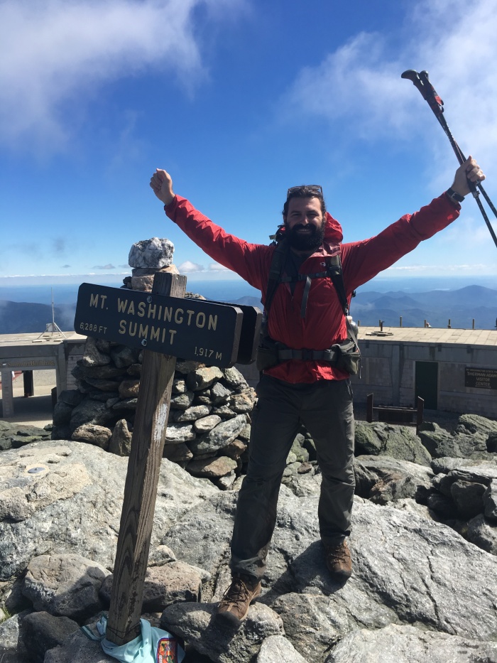
I may have mentioned it. This 6288′ behemoth isn’t the tallest peak along the AT, that title belongs to Clingman’s Dome. But it is most certainly the biggest mountain. Seen from 100 miles away, talked about for ten times farther. Home to the most erratic weather in the Americas (maybe the planet), and the highest wind speeds humankind has recorded. No other mountain wears a plaque naming the 150 people who have died on it.
But, let’s not get ahead. (I know.)

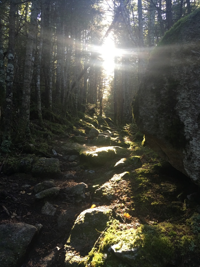
From the get-go, the trail through New Hampshire was RUGGED. Rocks everywhere and tough climbing. Class 4 climbs were not uncommon.
The first mountain in the Whites was Mt. Moosilauke. A long and steep early morning climb was worth the effort to have a late breakfast on the peak.

Over the big Moose, I was into Lincoln, NH where thru-hiker Dan and his wife, Nanette were gracious enough to offer a place to stay and wash up. Thanks, guys!
After a little bit of rain, the sun reappeared and I was through Kinsman Notch and over North and South Kinsman Mountains. The late afternoon views were wonderful.


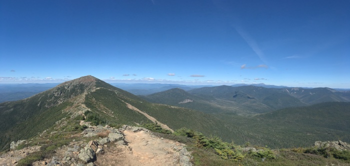
Down into Franconia Notch and back up again onto the Franconia Range. Little Haystack Mountain, Mt. Lincoln, and Mt. Lafayette offered some incredible scenes on a crisp, clear day.

The next day would bring more great weather up Mt. Garfield, South Twin Mountain, Mt. Guyot, and the beautiful Zealand Falls. I’d make a peaceful camp in Crawford Notch along the Saco River after a long day.


The next morning I realized I was there. I was in the Presidential Range and on the doorstep of Mt. Washington.
…and there was a freaking storm coming.

Let’s talk about the huts for a minute. Throughout the Whites there are shelters known as huts. These shelters exist as a place of refuge in inclement conditions for adventurers traveling through the mountains. They’ve evolved a bit over the years into more of a reservation only weekend hiker’s mountain getaway from city life, but at their core they are there to keep people out of bad weather.
There was a hut 7 miles away. That morning I’d get going, watching the sky, up Mt. Webster and later Mt. Jackson. I wasn’t too far from the hut when the wind, rain, and clouds rolled in. It was as if I was hiking in a tropical storm. I got wet. I tried not to get blown over. And I hauled ass.
I made it to the hut as the climate deteriorated, dried myself out, and had a hot meal. I wasn’t going any further that day. A Mt. Washington summit would have to wait. Later, I learned that visibility above treeline had dropped to zero and wind speeds would reach over 100 mi/hr. A shout out to Chris and the Mizpah Crew for letting me stay!

For all the bad weather that day, the next day was worth the wait. Clear, blue skies and nearly no wind. I couldn’t have asked for more perfect conditions to hike the Presidential Range and to summit Mt. Washington. What a day.

In the next few days, I would make my way over Mt. Madison, down into Pinkham Notch, over the Wildcats, and into Gorham, NH where I would say goodbye to Mt. Washington and the White Mountains. A truly awesome section of trail.

After a stop in Gorham, I crossed my last state line. 13 states were complete, 1 was left. I was now in Maine.

Southern Maine continued the beauty that I saw through New England. It also ramped-up the rugged, technical climbing I experienced through NH.
Southern Maine was TOUGH. But it also had some amazing views.

Just a few more days until I made it into Andover, ME. My first town in my last state.
Katahdin was now on the horizon.
SFSSF:
Miles: 1930.7
Highest Elevation: 6288′ (Mt. Washington)
Mountains: 221!
Pop Tarts: 71
Triple Doubles: 4
