
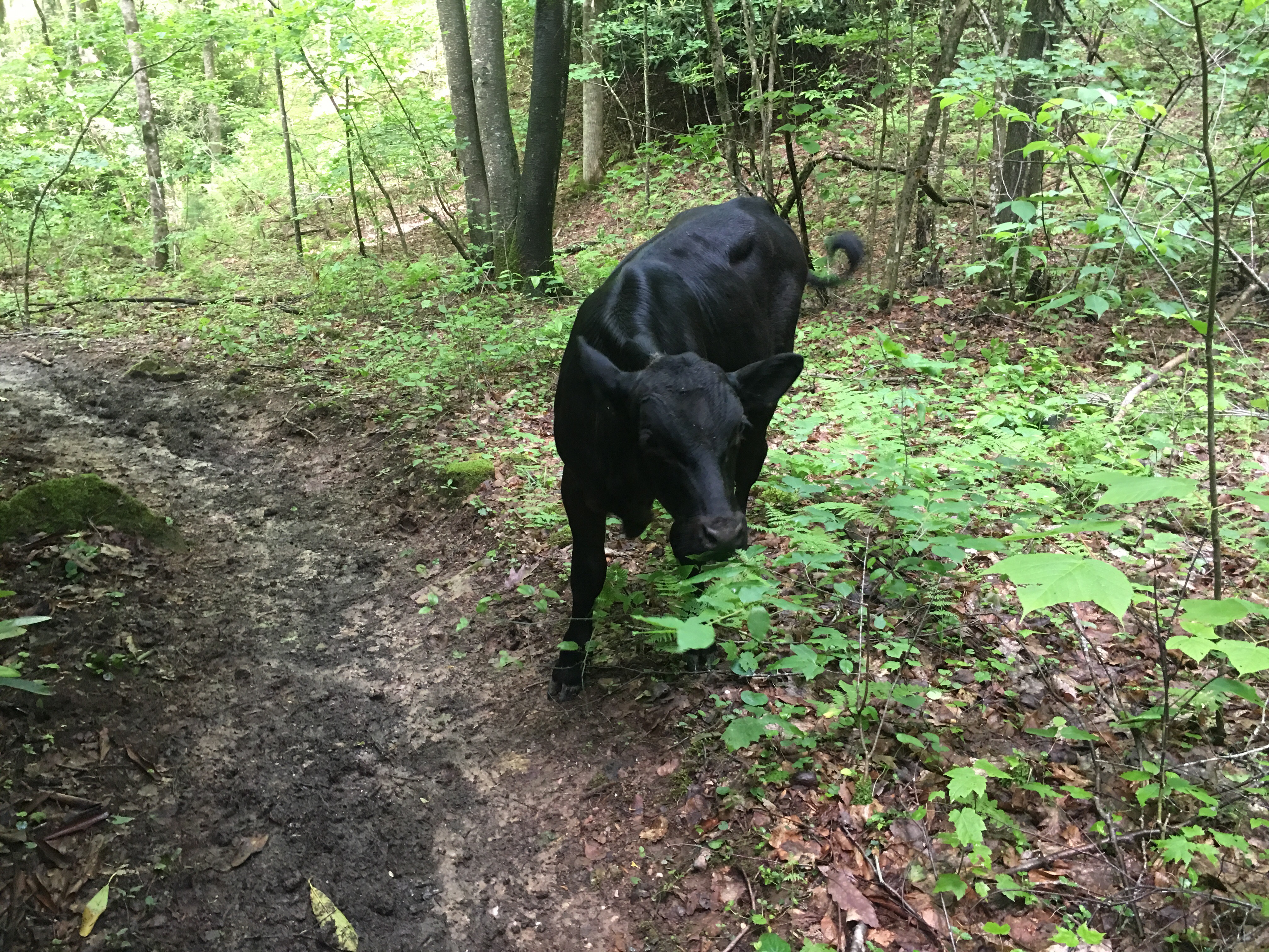
So there’s a bunch of trail in Virginia…554 miles worth of it. It hosts by far the largest portion of the AT of any state. I knew I’d be here for a while, and I couldn’t have been greeted by a finer welcoming commitee:
(For the record, they didn’t moove.)
One distinct difference in VA is the amount of open pasture the AT passes through. A welcome change from the ‘green tunnel’ of the forests south of here. And as an added bonus, the very hiker-friendly livestock that roam these pastures.
Out of Damascus, it didn’t take long to get back into elevation. 27 miles of climbing and I was at the highest peak in Virginia, Mt. Rogers. The weather was nice, so I decided to camp in an open spot on the mountain. A good choice.
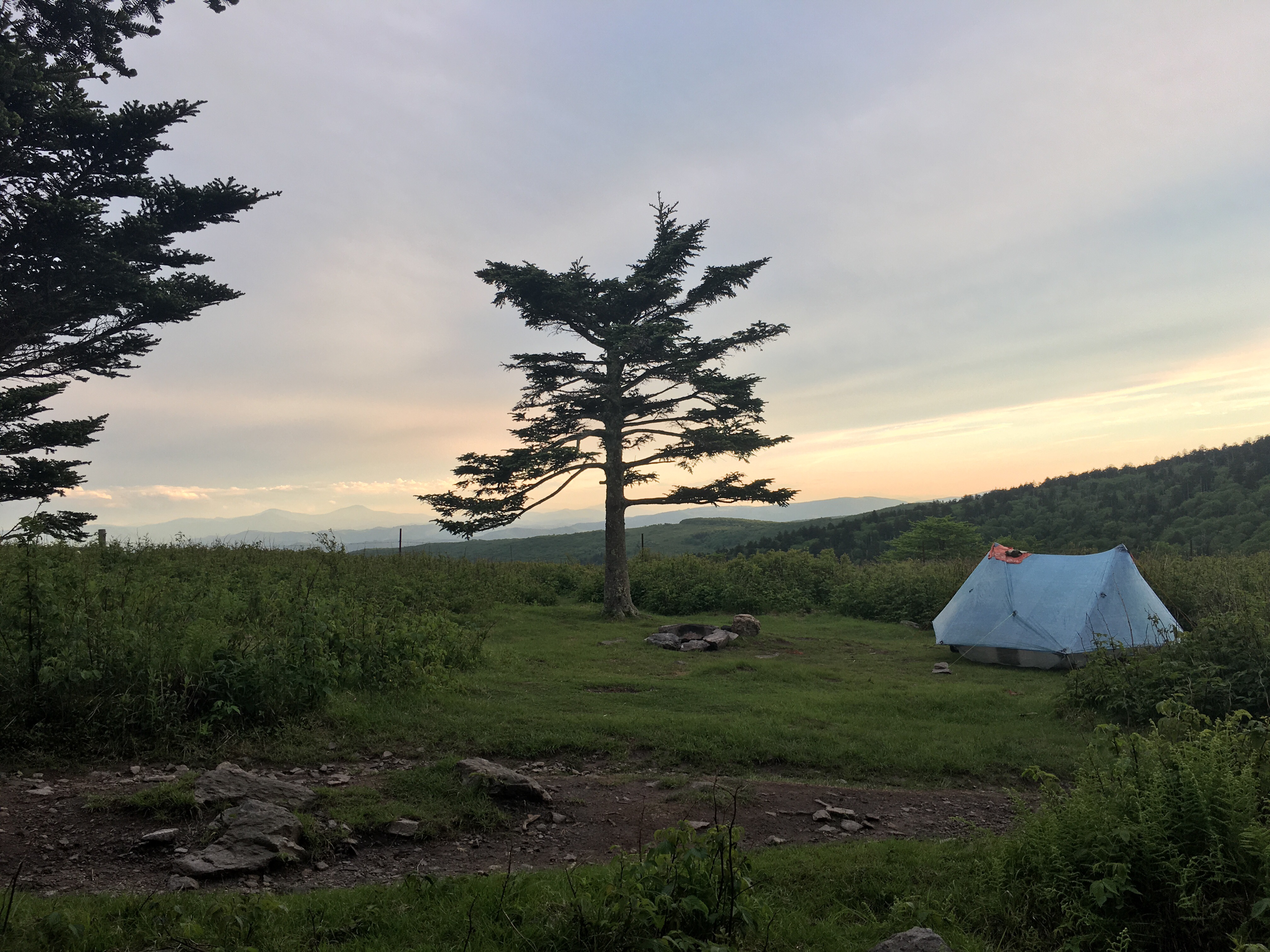
A sky full of stars at 5500′ is something to see.
Rogers stands as the southern border of Grayson Highlands State Park, a beautiful day hike with amazing views and some interesting locals…ponies.
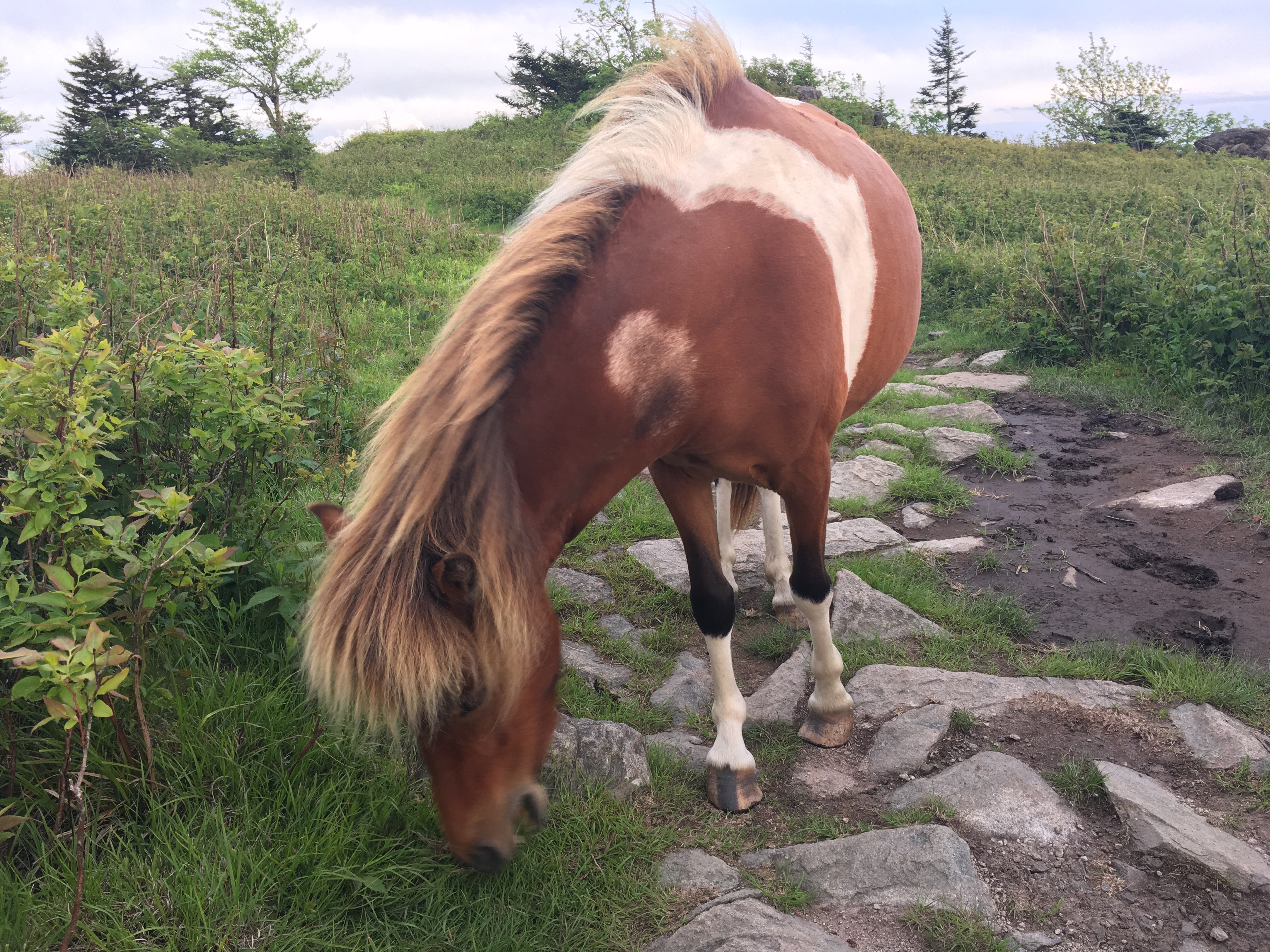
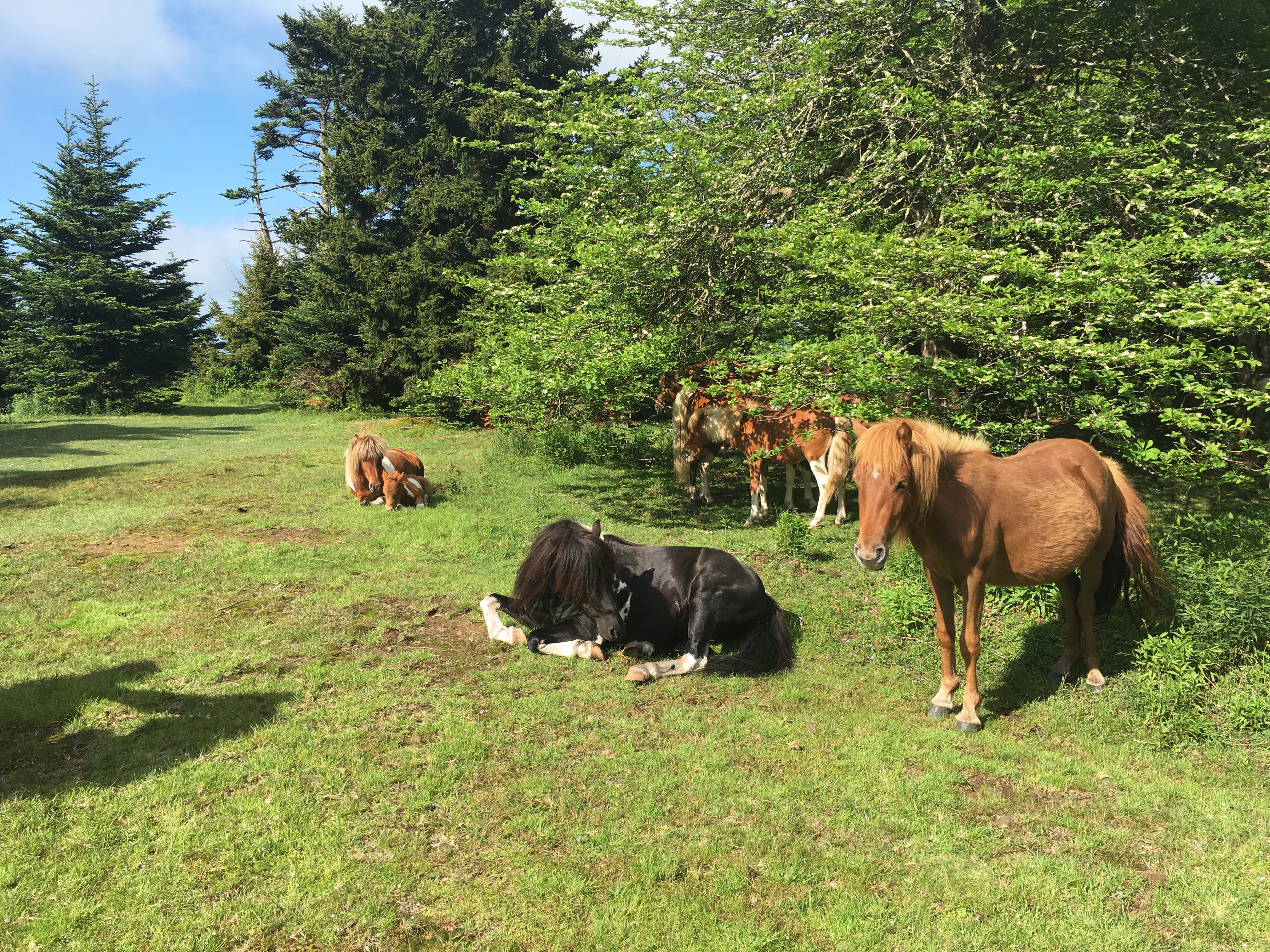
Left unattended, the area would quickly become overgrown. So, they were introduced in the 60s to basically act as free lawnmowers to the Forest Service. The ponies, who are hardy enough to hang out through winter, keep the unwanted vegetation under control throughout the year. Thanks for the hard work, guys.
A few days later I would cross another milestone, the 1/4 way point. I met a friend there to help me celebrate.
Dismal Falls were next up, what a great spot. A peaceful little waterfall with a swimming hole and camping. And since summer was now in full effect, a nice way to cool off.
The next night I would stay at the Woods Hole Hostel, just outside of Pearisburg. A mountain retreat offering accomodations to thru-hikers. The owners there keep vegetable gardens, bees, and livestock in a pseudo-homestead environment. They host visitors in a yoga/meditation-infused, slightly hippie, communal-living-experiment kind of way. Fascinating and relaxing. It was worth the price of admission to get to prepare, what is now widely considered, the most badass hiker breakfast on the planet.
A quick stop and resupply in Pearisburg and I was on the road again. So far, settling into Virginia nicely.
SFSSF:
Miles: 648.8
Mi/Day: 12.7
Highest Elevation: 5728′ (Mt. Rogers)
Mountains: Way more than last time
Pop Tarts: 32

Why are the falls dismal?
Did you keep a pony?
Are you riding a pony now?
If not why not?
Change your socks.
LikeLike
I didn’t stay long enough to find out
Yes, Bill is carrying all my shit now
My contract with Bill doesn’t include carrying hikers
Socks on rotation
LikeLike
These posts and photos are amazing! Thanks for sharing and filling us in on your journey! Can’t wait to read the next one!
Love you, Brooke
LikeLike
Thanks Brooke!
LikeLike
Incredible work Brandon. Really enjoying keeping up with the trip!
LikeLike
Thanks Bob!
LikeLike
Glad to see you are still making good headway with the hike. Places and sights are really beautiful as usual. Your tent looked like a white ant hill with that backdrop. And I wouldn’t blame you a bit if you were to commandeered one of the ponies for a while. 😜😜😜😜😆😆😄
Take care, be careful, awaiting you next entry !!!
Uncle Pascal
LikeLike
On that particular mountainside, you really do get a sense of your relative size. Beautiful place
LikeLike
Did you try to ride a pony?
LikeLike
Ha, no I didn’t, they didn’t look like the riding type
LikeLike
Your writings and photos are beautiful. Thanks for sharing and congrats on reaching the first quarter marker. Happy hiking!
LikeLike
Thanks Brenda!
LikeLike
Hello, once again great commentary and pictures! Very glad to see ponies and cattle! Love, Dad
LikeLike
Love those moos and horses. It means too no bears around!! So glad you are having this wonderful experience.
Love you
Tia Maria
LikeLike
Love your posts and your pictures! I want to be you when I grow up.
LikeLike
Thanks Jen! I’ll try to be a good example 😊
LikeLike
We are all enjoying your blog and seeing the beautiful pictures. Hope all is well? My niece who loves to hike asked me how are feet holding up? She did a two week hike in Colorado and hers definitely had blisters in the end. It is really fun to see your journey, you know we are living vicariously through you. Strange thing is none of us get tried of all the walking.
LikeLike
Thanks Susan! Feet are holding up well. A few blisters in the first couple weeks, but they’ve toughened up. Just takes a little while getting used to walking everyday.
LikeLike